Showing posts with label Utah County. Show all posts

Saturday, July 12, 2014

Thistle, Utah County

Thistle, named for the Canadian Thistle that you see all over that little valley, is different from any other ghost town. The town didn't die because a mine went dry. If it wasn't destroyed by water, there would still be ranchers living there and I would not have visited it.

Canadian Thistle with a flooded house, buried in water, mud and duck weed.
Years ago, my in laws went to Washington D.C.. When visiting the Vietnam Memorial, they realized there was no one they knew whose name would appear on the wall. They decided to see if there were any Shaws from Utah. There are a lot of Shaws, but none from Utah. Rather than a Shaw, they came to the name Blaine Joseph Shepherd SP5. (follow the link to see his picture!) He was from Thistle, Utah.


 The Dominguez-Escalante Expedition were led through a Native American trade route and recorded in their journals the first Europeans to cross through what would be later called Thistle. Utes living in Spanish Fork Canyon clashed with the newcomers that followed until they were relocated in the 1870s. The population of Thistle was less than 80 people.
Thistle was settled in 1848 by the Pace family coming with the Mormons from Nauvoo, Illinois. Five generations later, the Pace family are still cattle ranchers in the town. After the Pace family, settlers came to homestead the fertile ground. Then the railroads arrived.
The first railroad was built by the Utah and Pleasant Valley Railway in 1878, bought by the Denver and Rio Grande Western in a foreclosure sale in 1882. This completed the link from Salt Lake City to Denver (which subsequently ended the traffic going to Promontory, Utah).
Facilities were built in Thistle to service the trains. The town also provided a meal service for the trains as on-board dining cars weren't around yet. More residents employed by the railroad moved in to Thistle.
Traffic going through Thistle was heavy when Thistle became a bridge line for transcontinental rail traffic. At its peak Thistle had a population of 417 (1920 Census). There was a five-stall roundhouse, depot, machine shop and structures to restock the passing trains. There was also a post office, general stores, barber shop, saloon, pool hall, bakeries and restaurants. The largest building was the two-story schoolhouse, built in 1911.
Flowers from my sister in law for Blaine Joseph Shepherd at the door of the old schoolhouse


Inside the steel window on the right side of the school (above photo)

In 1947 Blaine J. Shepherd was born. While he was in preschool the Denver & Rio Grande Western began to use diesel locomotives, which required less maintenance. Thistle was beginning to fade. I don't know what growing up in a dying town was like. One thing I do know, he loved to fly. He grew a mustache, which made him look older than he was. I don't know where he became a pilot, but when he was drafted for Vietnam, he was the crew chief on a 66-531 C (charlie) model UH-1 Gunship. It's a helicopter. He and a friend, Dale Weber, designed and built the dual door gun system for their helicopters. The only 2 aircraft that had them.
Then September 29, 1968, Blaine Shepherd's helicopter was shot down. The pilot, co-pilot and gunner died with him. Dale's crew looked for them for two days before their bodies were found and brought back to the United States. Blaine was buried in Springville and Dale named his aircraft Shepherd, painting the name on the pilot's doors. Shepherd did not live to see his little town evacuated.
The town shrank significantly after his death. The depot was torn down in 1972, the post office torn town in 1974. In 1983 only a few families remained, the ranchers.
The fall and winter of 1982-1983 had record-breaking rain and snow. As spring came, the mountains were so saturated they became unstable.
The D&RGW railroad had a special meeting in Denver to discuss the unstable land. April 13th and Utah Highway Patrol officer struck a new buckle in the highway that threw him against the roof of his car. Later that day, maintenance crews were struggling to keep US-6 open. (My father-in-law drove this highway to get to his work every weekend and worked during the week. This closure kept him from going to work.) The last train to go through Thistle was the westbound Rio Grande Zephyr. Then the railroad and the highway were closed. Trains were rerouted through WYOMING! Three days later the tracks were buried. A voluntary evacuation order was issued for the town of Thistle. Four days later, it was mandatory. A landslide covered the train tracks and blocked the river. Residents had less than two hours to pack their belongings and get out before water reached their house.


The landslide in the middle. You can see the waterline on the mountain!

Thistle's oldest resident, who Blaine must have known, celebrated her 90th birthday at the evacuation center. Two days later the mountain was moving about 2 feet per hour.  Utah Geological Survey says at its fastest it was 3.5 feet per hour!! The end of the day the highway was buried in 50 feet of soil and the waterline was at the rooftops of the houses. Governor Scott Matheson was informed of the situation, he requested federal aid and President Reagan issued the first presidential disaster area declaration for the state of Utah. The new lake was 3 miles long and 200 feet deep. The railroad, motivated by almost 1 billion dollars lost a day (in today's  money), rebuilt the track, completing it 3 months later and the highway was completed by November the next year. (My father-in-law, like many others, quit his job as the detour added 100 miles to the commute.)


The landslide 30 years later.
Landslide on the left. Top road is the old railroad. Now a dirt road in use. It connects to the old US-6. New railroad track on the bottom


All the signs telling Thistle's story are gone. The one on the right is all that's left, and it's so faded from the sun you can't read the captions

Bibliography:

"Census of Population and Housing". U.S. Census Bureau.

Milligan, Mark (May 2005). "Thistle Landslide Revisited, Utah County, Utah". Survey Notes (Utah Geological Survey) 37 (2).


Carr, Stephen L.; Edwards, Robert W. (1989). Utah Ghost Rails. Salt Lake City, Utah: Western Epics. ISBN 0-914740-34-2.


Sumsion, Oneita Burnside (1983). Thistle – Focus on Disaster. Springville, Utah: Art City Publishing Company. ISBN 0-936860-14-6.

http://army.togetherweserved.com/army/servlet/tws.webapp.WebApp?cmd=ShadowBoxProfile&type=Person&ID=68451

Sunday, June 15, 2014

Forest City, Utah County ... part 1


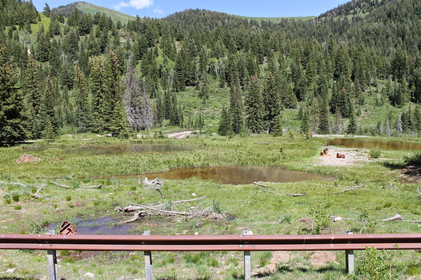
So, we went to find Forest City and instead found the remains of the smelter that gave birth to the town. I will be returning to find the town itself.

Located in the valley of Dutchman Flat in American Fork Canyon, just over the mountain from the ski haven of Alta, was a mining town called Forest City born in 1871 from the Sultana Smelter. The American Fork Railroad was meant to serve Forest City and the smelter, but, as pictures will show (next week, I'll take pictures of the road)... engineering difficulties and transportation costs were too much for the mines to be profitable. 


A narrow gauge railroad line was to run from Deer Creek (which was located where the fishing destination of Tribble Fork Reservoir is now) four miles up the rocky, scary (two way traffic on a one lane dirt road, with "Hairpin Turn".... cliff on one side, wall on the other. Yeah. At certain points it was a scary drive) dirt road. I assumed that road follows that old railroad plan, as I have no idea how else you could get to the smelter, and surely in the 21st century this is not a road Utah would plan.  The display there confirmed my suspicions.

There are no signs labeling Forest City when you make the treacherous drive up. (Thank you so much to my father-in-law for letting us use the Blazer!) My research told me all that remained was the cemetery. We missed the turn off for the cemetery (no signs to point my way and no map... besides my little drawing of our route), so I'll be going back tomorrow to find it again. I was please to find the remains of the smelter, though! The displays there told a little of Forest City's birth.
Three displays with precious little information about Forest City. Mostly it's about the Clean Water Act helping get the lead out of the water in this canyon.

Depending on the source, gold, silver, lead and other precious metals were discovered in American Fork Canyon by the Miller brothers in 1870." (source: the displays at the site about the mine and restoring the lead filled water) Or perhaps first, the 'mining boom began from Johnston's Army looking for gold, lead and silver in the early 1860's'. (source: Deseret News) Prospectors had staked claims by the hundreds and Forest City was born virtually overnight.

Over seven million dollars of gold, silver and lead was extracted between 1870 and 1920.  The smelter was built by the Miller Mining and Smelting Company for $90,000. The 'ore production peak in World War I' helped meet the demand of metals. It was the most successful operation in American Fork Canyon, going dry in the 1940s. However, from what I've gathered, I believe Forest City was a ghost long before then due to the inability to get a railroad up to the site.

Forest City served as a lumber town with several sawmills. There was a diary farm, post office, stables, boarding house, stage coach line,  two general stores, at least one hotel, houses and a "successful" saloon. I even found one source telling me there were enough children living there there was a school.


Forest City had about 150 (in 1871) permanent residents, though I found some estimates go as high as 3,000 in its short life. Certainly thousands passed through. The smelter alone employed 250-300 men in 1871. It was the most costly smelter in Utah Territory (again, that freaky road!). Forest City grew around it. Moving bullion and ore out of the canyon was costly. The Aspinwall Steamship Company (based in NYC. They bought the mine for $120,000) organized the American Fork Railroad Company to connect the town and smelter to the valley and save costs. The Utah Southern Railroad stopped at Sandy at the time (24 miles north in Salt Lake County). With a plan to extend the railroad south to Utah County, the new railroad planned to join it at American Fork. Construction began in May 1872, reaching the mouth of the canyon by August.


Then winter hit. The canyon shut down.  Diphtheria killed eleven children and five adults who now rest in unmarked graves in Graveyard Flat. (Pictures tomorrow!) There are no headstones left, and a fence around a historical marker is the best guess of where the cemetery's borders were.

By 1873 plans to build the railroad up to Forest City were abandoned. Miller Hill Mine stopped production in 1874. The smelter was dismantled in 1876. The rest of the mining was not enough to keep the railroad coming. Too unprofitable. So, 1878, the first Utah railroad to go out of business was the American Fork Railroad. The city was deserted by 1880. The dirt road destined to carry a railroad connecting the drowned ghost of Deer Creek and Forest City is now used by dirt bikes and four wheelers.


Look at those bolts and screws! WOW!

Barrels today are tack welded down. That middle ring was probably heated and dropped to the barrel, as it cools it fits.

Thick metal rope! No idea how old these awesome rusted pictures are, but hey! OLD! RUSTED! COOL!


Looking up the gap under the window


Smelter remains


Tribble Fork Reservoir. The town of Deer Creek used to be here.
Bibliography:
 Displays on site at Mineral Basin, American Fork Canyon

Shelley, George F. Early History of American Fork: With Some History of a Later Day (2nd ed.). American Fork City. p. 123. 

Utah Place Names. Salt Lake City, Utah : University of Utah. University of Utah Press, 1990.

Haddock, Sharon (October 28, 2004). "Cemetery on brink of oblivion". Deseret Morning News.